By Neha Dhull
Introduction
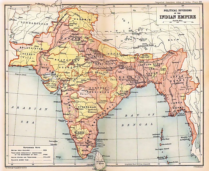
Borders, a by-product of cartographic methods, are a fairly recent creation. In the particular case of India, borders came about with the British Raj. Today, most borderlands are regarded as troubled paradise. In this paper, we are going to problematise the concept of borders and aim to look at them not from a political and international perspective but through the perspective of belonging and circulation. Borderlands reveal the shortcoming of cartography. For this reason, it is important to understand the cartographic methods which are employed to make this shift from frontiers (transnational zones) to borders (a clearly demarcated line). We will also look at the imagination of the people who live in borderlands and draw examples from the frontiers of India.
Circulation
Northern Frontier
Borderlands in the most rudimentary sense can be seen as areas which serve as connected geographies. One such borderland we are going to talk about here is Kashmir.
The cartographic mapping of Karakorum Mountains began with the Gilgit Agency to meet changing territorial demands of the colonial state. This cut local ties and led to colonial power mediating intervalley relationship.[1] The colonial power created a spatial understanding of India by using routes of access to expand administrative control over land and these routes became strategic in discovering borders themselves.
In 1846, the Treaty of Amritsar created the princely state of Jammu and Kashmir. To place boundary lines, the British were on the lookout to control and manipulate trans-frontier linkages and used two different policies to map border. On one hand, in west a clear border was mapped with Afghanistan. While on the other hand, in the north (China, Hunza, Gilgit Agency, Jammu & Kashmir, British India) the border was not clearly mapped. The British not only curbed and manipulated local trans-frontier linkages but also integrated the Gilgit Agency into British India.[2]
The British routes brought about a new pattern of circulation of ideas of people and goods. While generally routes entail a two-directional feature (flow into and flow out of a particular place), in the case of the Gilgit Agency, the flow was largely unidirectional, i.e., British troops, supplies, and colonial agents travelled into the region but rarely did people from Yasin, Hunza, Gilgit travelled towards India.[3]
This limited participation contributed to a lack of full integration in empire-wide circulation of human resources, which in turn contributed to mapping of boundaries.[4] Despite this, the colonial state legitimised its power through local rulers and simultaneously established power over the local rulers.
Eastern Frontier-Goalpara
Goalpara is another transitional region, i.e., borderland, which acted as a political frontier during the Mughal Empire and later became a colonial borderland. It acted as both a natural frontier and a cultural frontier.[5]
During the Mughal Period, Goalpara not only acted as a frontier but also had a complex local power hierarchy. That period is marked by circulatory regimes which existed. However, this is not to argue that there was no rigidity at all as there are umpteen examples of material fixity, structure of powers, and social hierarchies. This system largely remained unaffected by early interventions of the East India Company, but that soon changed as the British Crown took over.
As Goalpara lacked geographical compactness, the colonisers personified these differences by creating separate political units.[6] In the early twentieth century, due to intense economic change, ‘Colonisation of Wastelands’ scheme came about in which unprecedented migration took place from eastern Bengal to the western borders of the province of Assam (Goalpara and Cooch Behar). This resulted in a sharp rise in population, changes in land use patterns and reconstituted it as a separate marginal space. With colonialism, territory, economy, and culture came to be reimagined in a completely different way.
Goalpara has a plethora of contested narratives, which point towards its fragmentation into many borderlands. The narratives of Goalpara bring about a pre-colonial reality, which is based upon material and culture coming together seen in various practices of this region.[7] At the same time, the narratives of Goalpara as a cultural collective has differences with narratives of Assamese and Bengali identities.
Politics of Belonging
While circulation is an important way to problematise the concept of borders, it can also be looked at from a displacement point of view. In deriving an understanding of borderlands, remote places and historical events related to them have been largely ignored. This is due to the way in which we understand border crossing and transnationalism that hides the people who live in borderlands.
In many cases, the problematic relationship of conflict emerges where people are a subject of one state and are attached to another place.[8] In such situations it becomes important to emphasise upon belonging, i.e., how people themselves frame conflict with borders, as opposed to the state.
Belonging is a form of relational identity, i.e., being in one place and longing to be in another. Political projects which aim at constructing belonging can also contribute to resistance against them.[9] Therefore, not only is belonging political but also brings about a problematic aspect of space and place, in the form of displacement. For example, in case of Gilgit Baltistan, the region feels excluded from the state, even though it opted for Pakistan during the partition, because of its ambivalent status. This ambivalence makes it vulnerable.
For people living in both Baltistan and other parts of Kashmir borderland, there is the perception that they had more access to other places and regions before the LoC was established, e.g., their relations with Xinjiang, Tibet, Srinagar, Shimla, and Deoband, among others. There is discontent with the ways they are being identified and represented. They operate within limited existing political space and reposition as an identity seeking recognition. They re-establish direct ties with Ladakh not only for economic gains but also for political and cultural exchange. This form of imagination brings about a hybrid understanding of territory, i.e., borderland.[10]
Conclusion
Borderlands are referred to by Harris as ecotones which function more like transitional zones where ambiguity exists. It presents us with a more nuanced way of looking at the world. Borders just privilege one narrative over umpteen others.[11] In certain cases, borders can just be arbitrary lines. Willem van Schendel rightly describes borderlands as “places that disappear into the folds of the map…regions which are victims of cartographic surgery.” However, sometimes border narrative can present exactly opposite pictures, where ecosystems are formed as a causality of our own blunt and inflexible borders and self-serving stories. The border between South Korea and North Korea, serves as an example.
Border acts as an institution, where it is legitimised, challenged, transformed, and come to existence as a product of historical constructions, and in turn imposes upon those living in surrounding areas.[12] Here we have problematised the idea of borders both from the point of view of circulation and through the idea of belonging. And although these concepts may seem separate, they influence each other. The arbitrary ways which were used to mark boundaries, go to show the lack of integration into the wider national idea. It shows that international reality can often be challenged, bringing about a new understanding.
[1] Haines, Chad. “Colonial Routes: Reorienting the Northern Frontier of British India.” Ethnohistory, 51(3), (2004), pp. 535-565.
[2] Haines, Chad. “Colonial Routes: Reorienting the Northern Frontier of British India.” Ethnohistory, 51(3), (2004), pp. 535-565.
[3] Haines, Chad. “Colonial Routes: Reorienting the Northern Frontier of British India.” Ethnohistory, 51(3), (2004), pp. 535-565.
[4] Haines, Chad. “Colonial Routes: Reorienting the Northern Frontier of British India.” Ethnohistory, 51(3), (2004), pp. 535-565.
[5] Misra, Sanghamitra. Becoming a borderland: The politics of space and identity in colonial Northeastern India. New Delhi: Routledge India, (2011).
[6] Misra, Sanghamitra. Becoming a borderland: The politics of space and identity in colonial Northeastern India. New Delhi: Routledge India, (2011).
[7] Misra, Sanghamitra. Becoming a borderland: The politics of space and identity in colonial Northeastern India. New Delhi: Routledge India, (2011)
[8] Bouzas, Antía Mato. “(B)Ordering and the Politics of Belonging.” St Antony’s International Review 12, no. 2 (2017), pp. 114-35.
[9] Yuval Davis “Politics of Belonging” in Bouzas, Antía Mato. “(B)Ordering and the Politics of Belonging.” St Antony’s International Review 12, no. 2 (2017), pp. 114-35.
[10] Bouzas, Antía Mato. “(B)Ordering and the Politics of Belonging.” St Antony’s International Review 12, no. 2 (2017), pp. 114-35.
[11] Harris, Kate. “Lands of Lost Borders.” The Georgia Review 68, no. 3 (2014): 447-64.
[12] Bouzas, Antía Mato. “(B)Ordering and the Politics of Belonging.” St Antony’s International Review 12, no. 2 (2017), pp. 114-35.2017
Bio:
Neha Dhull is currently pursuing a Masters in Global Studies at Ambedkar University, Delhi. Her research interests include conflict studies, global development, and global feminist theory. Currently, she is working on her dissertation on Women in the Armed Forces.
***
Like Cafe Dissensus on Facebook. Follow Cafe Dissensus on Twitter.
Cafe Dissensus Everyday is the blog of Cafe Dissensus magazine, born in New York City and currently based in India. All materials on the site are protected under Creative Commons License.
***
Read the latest issue of Cafe Dissensus Magazine, “Pandemics/Epidemics and Literature”, edited by Nishi Pulugurtha, Kolkata, India.
